Lesson summary
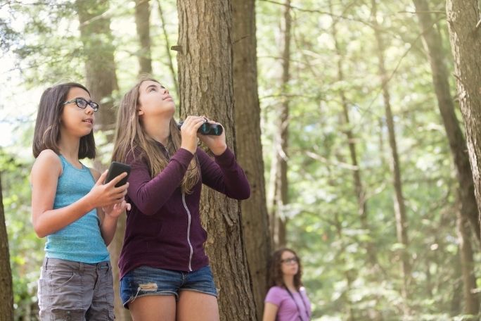
Students prepare information and materials to support users of a trail in or around your school where people can assess local biodiversity using a leading citizen science app. Students begin by creating a package of information to inform visitors about how to use their trail, including maps, field guides, ClimateWatch app details and recording sheets. Students then create a package of information to support future students analysing the data collected, including templates for graphs and charts, and suggestions on how to share this information.
Learning intentions:
Students will...
- be able to select, research and communicate scientific and geographical information
Success criteria:
Students can...
- support other students and/or community members to participate in citizen science programs
- share geographical and/or scientific information in a range of communication forms
- create templates for graphs, charts and tables.
- justify their decision making
Lesson guides and printables

Lesson details
Curriculum mapping
Australian curriculum content descriptions:
NOTE – This unit has been designed to be taught in either Geography or Science. To further enhance the learnings from this unit for students, consider teaching this as a cross-curricular unit of work.
Year 7 Geography:
- Represent data in a range of appropriate forms, for example climate graphs, compound column graphs, population pyramids, tables, field sketches and annotated diagrams, with and without the use of digital and spatial technologies (ACHGS049)
- Represent spatial distribution of different types of geographical phenomena by constructing appropriate maps at different scales that conform to cartographic conventions, using spatial technologies as appropriate (ACHGS050)
- Present findings, arguments and ideas in a range of communication forms selected to suit a particular audience and purpose; using geographical terminology and digital technologies as appropriate (ACHGS053)
Following collection of data from the school biodiversity trail:
- Apply geographical concepts to draw conclusions based on the analysis of the data and information collected (ACHGS052)
Year 8 Geography:
- Represent data in a range of appropriate forms, for example, climate graphs, compound column graphs, population pyramids, tables, field sketches and annotated diagrams, with and without the use of digital and spatial technologies (ACHGS057)
- Represent spatial distribution of different types of geographical phenomena by constructing appropriate maps at different scales that conform to cartographic conventions, using spatial technologies as appropriate (ACHGS058)
- Present findings, arguments and ideas in a range of communication forms selected to suit a particular audience and purpose; using geographical terminology and digital technologies as appropriate (ACHGS061)
Following collection of data from the school biodiversity trail:
- Apply geographical concepts to draw conclusions based on the analysis of data and information collected (ACHGS060)
Year 7 Science:
- Collaboratively and individually plan and conduct a range of investigation types, including fieldwork and experiments, ensuring safety and ethical guidelines are followed (ACSIS125)
- Construct and use a range of representations, including graphs, keys and models to represent and analyse patterns or relationships in data using digital technologies as appropriate (ACSIS129)
- Communicate ideas, findings and evidence based solutions to problems using scientific language, and representations, using digital technologies as appropriate (ACSIS133)
Following collection of data from the school biodiversity trail:
- Summarise data, from students’ own investigations and secondary sources, and use scientific understanding to identify relationships and draw conclusions based on evidence (ACSIS130)
Year 8 Science:
- Collaboratively and individually plan and conduct a range of investigation types, including fieldwork and experiments, ensuring safety and ethical guidelines are followed (ACSIS140)
- Construct and use a range of representations, including graphs, keys and models to represent and analyse patterns or relationships in data using digital technologies as appropriate (ACSIS144)
- Communicate ideas, findings and evidence based solutions to problems using scientific language, and representations, using digital technologies as appropriate (ACSIS148)
Following collection of data from the school biodiversity trail:
- Summarise data, from students’ own investigations and secondary sources, and use scientific understanding to identify relationships and draw conclusions based on evidence (ACSIS145)
Syllabus outcomes: GE4-7, GE4-8, SC4-5WS, SC4-6WS, SC4-7WS, SC4-9WS.
General capabilities: Critical and Creative Thinking.
Cross-curriculum priority: Sustainability OI.6.
Relevant parts of Year 7 Geography achievement standards: Students record and represent data and the location and distribution of geographical phenomena in a range of forms, including large-scale and small-scale maps that conform to cartographic conventions. They interpret and analyse data and other information to propose simple explanations patterns, trends and relationships, and draw conclusions. Students present findings and arguments using relevant geographical terminology and digital technologies in a range of communication forms.
Relevant parts of Year 8 Geography achievement standards: Students select, record and represent data and the location and distribution of geographical phenomena in a range of appropriate digital and non-digital forms, including maps at different scales that conform to cartographic conventions. They analyse data and other information to propose explanations for spatial distributions, patterns, trends and relationships, and draw reasoned conclusions. Students present findings, arguments and ideas using relevant geographical terminology and digital technologies in a range of appropriate communication forms.
Relevant parts of Year 7 Science achievement standards: They plan fair experimental methods, identifying variables to be changed and measured. They summarise data from different sources and describe trends in their data. They communicate their ideas, methods and findings using scientific language and appropriate representations.
Relevant parts of Year 8 Science achievement standards: Students plan investigations, including designing field or experimental methods. They construct representations of their data to reveal and analyse patterns and trends, and use appropriate language and representations to communicate science ideas, methods and findings in a range of text types.
Unit of work: ClimateWatch: Citizen Science – Geography and Science – Years 7 & 8.
Time required: 210+ min.
Level of teacher scaffolding: Medium – facilitate class discussion and lead students in creation of materials.
Resources required
- Tablets with ClimateWatch app installed
- Internet access
- Student Worksheets – one copy per student
- Device capable of presenting a video to the class (optional)
- Digital camera (optional)
Skills
This lesson is designed to build students’ competencies in the following skills:
- Collaboration
- Communication
- Community engagement
- Critical thinking
- Digital literacy
- Problem solving
Additional info
The lessons in this unit have been developed in partnership with Earthwatch. Earthwatch developed the ClimateWatch program with the Bureau of Meteorology and The University of Melbourne to understand how changes in temperature and rainfall are affecting the seasonal behaviour of Australia’s plants and animals.
Welcome back!
Don't have an account yet?
Log in with:
By signing up to Cool.org you consent and agree to Cool's privacy policy to
store, manage and process your personal information. To read more, please see
our privacy policy here(Opens in new tab).
Create your free Cool.org account.
Many of our resources are free, with an option to upgrade to Cool+ for premium content.
Already have an account?
Sign up with:
By signing up to Cool.org you consent and agree to Cool's privacy policy to
store, manage and process your personal information. To read more, please see
our privacy policy here(Opens in new tab).