Lesson summary
Students will create and label a map of the state of Tasmania. They will conduct online research to find out about and mark key natural features on the map. Students will observe the distribution of natural features, including water resources, and discuss the ways in which they connect places and people.
Learning intentions:
Students will...
- learn to work with maps, consulting existing maps to draw and adapt their own
- identify the distribution of natural features, including water reserves, in Tasmania.
Lesson guides and printables

Lesson details
Curriculum mapping
Australian curriculum content descriptions:
Year 7 Science:
- Water is an important resource that cycles through the environment (ACSSU222)
- Some of Earth’s resources are renewable, but others are non-renewable (ACSSU116)
Year 7 Geography:
- The classification of environmental resources and the forms that water takes as a resource (ACHGK037)
- The ways that flows of water connect places as it moves through the environment and the way this affects places (ACHGK038)
Year 8 Science:
- Science understanding influences the development of practices in areas of human activity such as industry, agriculture and marine and terrestrial resource management (ACSHE136)
Year 8 Geography:
- The different types of landscapes and their distinctive landform features (ACHGK048)
- Apply geographical concepts to draw conclusions based on the analysis of the data and information collected (ACHGS060)
Syllabus Outcomes: GE4-1, GE4-2, GE4-3, GE4-4, GE4-5, GE4-7, GE4-8.
Time required: 60 mins
Level of teacher scaffolding: Medium – oversee activity and facilitate discussion.
Resources required
- Lead and coloured pencils
- Erasers
- Thin to medium black pens or markers
- One sheet of A3 paper for each student
- Access to online map resources or atlases to be shared among students
- Student Worksheet – one copy per student
- OR computers/tablets to access the online worksheet
Additional info
This lesson has been developed in partnership with
Hydro Tasmania.
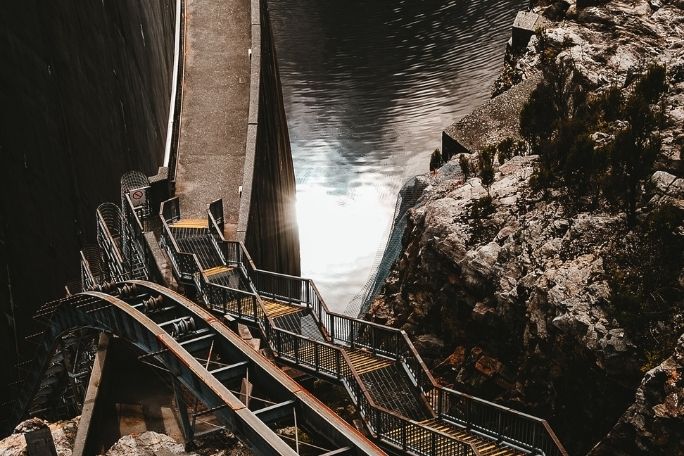
Hydro Tasmania has been at the forefront of clean energy innovation for one hundred years. It is Australia’s largest producer of clean energy – generating hydro and wind power – and the largest water manager. Hydro Tasmania has 55 major dams, operates 30 hydropower stations and has built some of Australia’s largest wind farms.
Hydro Tasmania also sells energy in the National Electricity Market through its retail business Momentum Energy, and sells its expertise internationally through its consulting business Entura.
Visit the Hydro Tasmania website to learn how the business is working towards Australia’s clean energy future.
Welcome back!
Don't have an account yet?
Log in with:
By signing up to Cool.org you consent and agree to Cool's privacy policy to
store, manage and process your personal information. To read more, please see
our privacy policy here(Opens in new tab).
Create your free Cool.org account.
Many of our resources are free, with an option to upgrade to Cool+ for premium content.
Already have an account?
Sign up with:
By signing up to Cool.org you consent and agree to Cool's privacy policy to
store, manage and process your personal information. To read more, please see
our privacy policy here(Opens in new tab).