Lesson summary
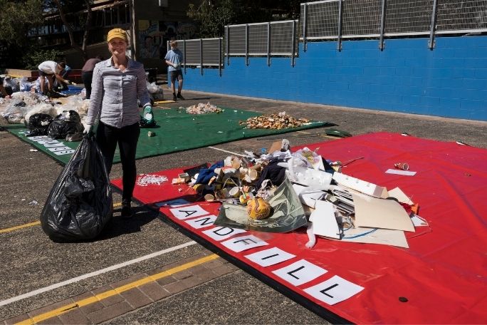
In this lesson, students conduct an audit of litter at their school. They begin by reviewing their knowledge of litter before participating in a school litter audit to find out the distribution and composition of litter at their school. They work in groups to explore sections of the schoolyard, identifying litter hotspots and the composition of litter in their assigned sections, recording this information on a map and through taking photographs. Students then assess and analyse their data, coming together to form a big picture of litter at your school. Students can use the results of their litter audit to develop a plan to reduce littering at their school during the follow-up social action lesson.
Learning intentions:
Students will...
- understand what litter is, where it comes from and how it can impact on our environment
- understand why conducting a litter audit is important when wanting to improve waste disposal
- recognise some of the steps to conducting a litter audit.
Success criteria:
Students can...
- work with and create relevant maps
- work collaboratively to collect data
- analyse data to draw conclusions
- participate in group and class discussions.
Lesson guides and printables

Lesson details
Curriculum mapping
Australian curriculum content descriptions:
Year 7 Science:
- Some of Earth’s resources are renewable, including water that cycles through the environment, but others are non-renewable (ACSSU116)
Year 7 Mathematics:
- Identify and investigate issues involving numerical data collected from primary and secondary sources (ACMSP169)
- Construct and compare a range of data displays including stem-and-leaf plots and dot plots (ACMSP170)
Year 7 Geography:
- Evaluate sources for their reliability and usefulness and select, collect and record relevant geographical data and information, using ethical protocols, from appropriate primary and secondary sources (ACHGS048)
Year 8 Science:
- Solutions to contemporary issues that are found using science and technology, may impact on other areas of society and may involve ethical considerations (ACSHE135)
Year 8 Mathematics:
- Choose appropriate units of measurement for area and volume and convert from one unit to another (ACMMG195)
- Investigate techniques for collecting data, including census, sampling and observation (ACMSP284)
Year 8 Geography:
- Evaluate sources for their reliability and usefulness and select, collect and record relevant geographical data and information, using ethical protocols, from appropriate primary and secondary sources (ACHGS056)
- Represent data in a range of appropriate forms, for example, climate graphs, compound column graphs, population pyramids, tables, field sketches and annotated diagrams, with and without the use of digital and spatial technologies (ACHGS057)
Year 9 Mathematics:
- Identify everyday questions and issues involving at least one numerical and at least one categorical variable, and collect data directly and from secondary sources (ACMSP228)
Year 9 Geography:
- Evaluate sources for their reliability, bias and usefulness and select, collect, record and organise relevant geographical data and information, using ethical protocols, from a range of appropriate primary and secondary sources (ACHGS064)
- Represent multi-variable data in a range of appropriate forms, for example scatter plots, tables, field sketches and annotated diagrams, with and without the use of digital and spatial technologies (ACHGS065)
Year 10 Geography:
- Evaluate sources for their reliability, bias and usefulness and select, collect, record and organise relevant geographical data and information, using ethical protocols, from a range of appropriate primary and secondary sources (ACHGS073)
- Represent multi-variable data in a range of appropriate forms, for example scatter plots, tables, field sketches and annotated diagrams, with and without the use of digital and spatial technologies (ACHGS074)
Syllabus outcomes: SC4-12ES, GE4-7, GE5-7
General capabilities: Critical and Creative Thinking, Numeracy
Cross-curriculum priority: Sustainability OI.7, OI.9
Relevant parts of Year 7 Science achievement standards: Students analyse how the sustainable use of resources depends on the way they are formed.
Relevant parts of Year 7 Mathematics achievement standards: Students construct stem-and-leaf plots and dot-plots. They identify issues involving the collection of continuous data.
Relevant parts of Year 7 Geography achievement standards: Students evaluate a range of primary and secondary sources to locate useful information and data. They record and represent data and the location and distribution of geographical phenomena in a range of forms.
Relevant parts of Year 8 Science achievement standards: Students explain how evidence has led to an improved understanding of a scientific idea
Relevant parts of Year 8 Mathematics achievement standards: Students convert between units of measurement for area and volume. They explain issues related to the collection of data.
Relevant parts of Year 8 Geography achievement standards: Students evaluate a range of primary and secondary sources to locate useful and reliable information and data. They select, record and represent data and the location and distribution of geographical phenomena in a range of appropriate digital and non-digital forms.
Relevant parts of Year 9 Mathematics achievement standards: Students compare techniques for collecting data from primary and secondary sources.
Relevant parts of Year 9 Geography achievement standards: They evaluate a range of primary and secondary sources to select and collect relevant and reliable geographical information and data. They record and represent multi-variable data in a range of appropriate digital and non-digital forms.
Relevant parts of Year 10 Geography achievement standards: Students critically evaluate a range of primary and secondary sources to select and collect relevant, reliable and unbiased geographical information and data. Students record and represent multi-variable data in the most appropriate digital and non-digital forms.
Unit of work: War On Waste – Years 7-10
Time required: 120+ mins
Level of teacher scaffolding: High – oversee class discussion and auditing processes
Resources required
- Camera or device with a camera
- A device capable of presenting a website to the class
- Litter Key Table – enough copies for small group work
- Map or plan of school (hard copy or printed from Google Maps)
- Rubber gloves
- Student Worksheet – one copy per student
- Waste Safety Code
Skills
This lesson is designed to build students’ competencies in the following skills:
- Collaboration
- Communication
- Critical thinking
- Leadership
Additional info
Cool Australia’s War On Waste lessons have been developed in partnership with Lune Media and with support from the Australian Environmental Grantmakers Network. These lessons have been designed to lead students through a deeper understanding of some of the big issues relating to waste in Australia and to support them to take action to reduce the impact of waste on our environment.
Welcome back!
Don't have an account yet?
Log in with:
By signing up to Cool.org you consent and agree to Cool's privacy policy to
store, manage and process your personal information. To read more, please see
our privacy policy here(Opens in new tab).
Create your free Cool.org account.
Many of our resources are free, with an option to upgrade to Cool+ for premium content.
Already have an account?
Sign up with:
By signing up to Cool.org you consent and agree to Cool's privacy policy to
store, manage and process your personal information. To read more, please see
our privacy policy here(Opens in new tab).